
Adler Planetarium
Back to Adler Planetarium
Back to Adler Planetarium
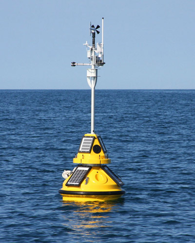
Buoys have the deets
Throughout the Great Lakes, an extensive system of environmental tracking stations, buoys, and research vessels help scientists and government officials keep an eye on the region. These tools are constantly collecting and transmitting data like air and water temperature, wind speeds, wave height and direction, and atmospheric pressure. The information is used to warn the public of hazardous conditions, protect water quality, and improve weather forecasts.
For example, experts use data on wave height and frequency to predict where strong waves and rip currents are likely to create dangerous swimming conditions. Keeping track of rainfall, currents, and water clarity helps city officials determine when high bacteria levels make swimming unsafe. And since most of the local data is available to the public, boaters and beach-goers can use it to plan trips to the lake. Anglers can even use information on water temperature to know where to find specific species of fish.
For example, experts use data on wave height and frequency to predict where strong waves and rip currents are likely to create dangerous swimming conditions. Keeping track of rainfall, currents, and water clarity helps city officials determine when high bacteria levels make swimming unsafe. And since most of the local data is available to the public, boaters and beach-goers can use it to plan trips to the lake. Anglers can even use information on water temperature to know where to find specific species of fish.