Monroe Harbor
Back to Monroe Harbor
Back to Monroe Harbor
The lakefront 2.0
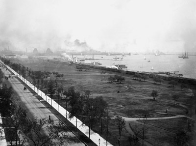
The first European settlers found the shoreline near where Michigan Avenue is now. Expansion into the lake began in the late 1800s, when debris from the Great Chicago Fire was used to create land that eventually grew to become Grant Park. Over roughly 50 years, eastern Chicago grew by about 2,000 acres with the help of landfill, ash, and dirt. Much of this work, including the expansion of Grant Park, was inspired by the famous 1909 Plan of Chicago, which introduced ideas for converting the lakefront into public land.
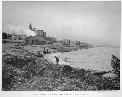
The city has historically struggled to control erosion along its entirely man-made shoreline. Changing water levels and winter storms have chipped away at beaches, filled in navigation channels and harbors, and damaged breakwaters and other structures designed to prevent coastal erosion. Ironically, these structures have sped up erosion in places by moving sand and exposing finer lakebed sediments to waves they cannot withstand. The battle with erosion has led to several redevelopment projects over the decades, including one that extended the shoreline north of downtown to create a larger buffer between Lake Shore Drive and the lake.
The city has historically struggled to control erosion along its entirely man-made shoreline. Changing water levels and winter storms have chipped away at beaches, filled in navigation channels and harbors, and damaged breakwaters and other structures designed to prevent coastal erosion. Ironically, these structures have sped up erosion in places by moving sand and exposing finer lakebed sediments to waves they cannot withstand. The battle with erosion has led to several redevelopment projects over the decades, including one that extended the shoreline north of downtown to create a larger buffer between Lake Shore Drive and the lake.